
Where do Islamorada charters leave from?
There is no single charter dock here and no harbour the fleet gathers in. OpenStreetMap maps 8 named marinas in the village, strung along about 8 miles of the Overseas Highway. Two of them, Bud n' Mary's and Robbie's, are confirmed charter operators in their own right. For the rest, which one your boat uses is the operator's to tell you, so get the street address when you book rather than navigating to a business name.
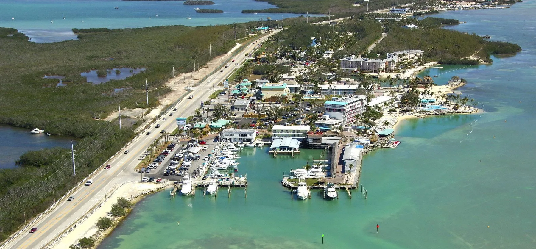
The shape of this place is a line, not a harbour
In most charter towns there is somewhere you would go if nobody told you where to go. A row of boats, a seaport, a working basin. Ask for directions and someone points.
Islamorada is not arranged that way. The marinas sit along the Overseas Highway, and the run from the southernmost mapped one to the northernmost is about 8 miles. At six in the morning that is a drive, and it is a drive in one of two directions, only one of which is right.
So the mistake here is not choosing the wrong dock from a short list. It is assuming there is a list at all.
The 8 named marinas
Ordered south to north, which is geography and not a ranking. Each row is an OpenStreetMap feature read on 10 September 2026 and carries the object id so you can check it. 7 of the 8 have a website recorded; 5 have no street address in the data, and that gap is shown rather than filled in.
| Marina | Address in OSM | Website in OSM | OSM object |
|---|---|---|---|
| Robbie's Southernmost of the mapped set. Widely known for the tarpon feeding rather than for charter departures, which may make it a landmark rather than a dock you leave from. OSM has no website tag for it. | 77522 Overseas Highway | Not recorded | node/3058878543 |
| Bud n'Mary's Marina | 79851 Overseas Highway | Their site | way/965364676 |
| Bayside Marina ⚠ ITS ONLY WEB LINK IS A BASS PRO STORE PAGE. That is a tackle retailer, not a charter dock. Establish what this actually is before it appears on any page. | Not recorded | Their site | way/396013568 |
| Caribee Boat Sales & Marina Named as boat SALES first. May not take charter bookings at all. | Not recorded | Their site | way/965392909 |
| Coral Bay Marina | Not recorded | Their site | node/3058734961 |
| Whale Harbor Marina | Not recorded | Their site | node/3058734957 |
| Snake Creek Marina | 85401 Overseas Highway | Their site | node/3058696699 |
| IslaMarina Northernmost of the mapped set. | Not recorded | Their site | way/965374081 |
A ninth marina is mapped with no name recorded and is therefore not in this table. It is counted in the total rather than dropped: an unnamed feature is a marina whose name nobody entered, not one that is not there.
- Robbie's — 77522 Overseas Highway Southernmost of the mapped set. Widely known for the tarpon feeding rather than for charter departures, which may make it a landmark rather than a dock you leave from. OSM has no website tag for it.
- Bud n'Mary's Marina — 79851 Overseas Highway
- Bayside Marina ⚠ ITS ONLY WEB LINK IS A BASS PRO STORE PAGE. That is a tackle retailer, not a charter dock. Establish what this actually is before it appears on any page.
- Caribee Boat Sales & Marina Named as boat SALES first. May not take charter bookings at all.
- Coral Bay Marina
- Whale Harbor Marina
- Snake Creek Marina — 85401 Overseas Highway
- IslaMarina Northernmost of the mapped set.
Ask for the address, not the name
This is the one instruction on the page and it holds regardless of what a later scan turns up.
Several operators can share a marina, so a company name may put you in the right car park and the wrong slip. Marinas get renamed when a resort changes hands. And the data is patchy in a way that is easy to see above: of 8 named marinas, 3 carry a street address in OpenStreetMap and 5 do not.
When you book, ask for the street address and the name of the boat. Put the address in your phone. Then ask what time they want you there, which is not the same question as what time the boat leaves.
Check it at the source
The marina positions come from OpenStreetMap. These are the bodies that govern the water they open onto.
- Florida Keys National Marine Sanctuary Sanctuary zones, marked areas and restrictions that overlay the entire Keys fishery. Link checked 6 September 2026
- FWC — Recreational saltwater fishing regulations Current state size limits, bag limits and seasons, species by species. Link checked 6 September 2026
- Islamorada, Village of Islands The municipality. It does not operate the marinas — those are private, and each sets its own access and parking. Link checked 6 September 2026
Marina questions
Where do Islamorada fishing charters leave from?
Partly answered now. Two of the eight mapped marinas, Bud n’ Mary’s and Robbie’s, run charters themselves and appear in the operator scan. The other six are marinas this site has confirmed exist but not confirmed as departure points, and which one a given charter uses is set by that operator. Get the street address from whoever you book with.
Is there one main marina?
No, and that is the useful part. There is no harbour here that the fleet gathers in. The marinas follow the road, and the run from the southernmost mapped one to the northernmost is about eight miles. Somebody who assumes there is a default place to turn up is the person who arrives at the wrong one.
Can I just put the marina name into my maps app?
Put the street address in, not the name. Several operators can share one marina, marinas get renamed when a resort changes hands, and a business name does not reliably resolve to a slip. Two of the eight below carry a street address in OpenStreetMap and six do not, which is a fair illustration of how patchy name-to-place data is here. Ask for the address at the time of booking.
Does this site say which marina is best?
No. The list is ordered south to north, which is geography rather than judgement. Ranking them would need something to rank on, and while six operators have now been read, no rate and no review has been read for any of them.
Where did this list come from?
The Overpass API, which queries OpenStreetMap, on 10 September 2026. It asked for every marina feature in the box 24.83,-80.72 to 24.97,-80.57 — deliberately a little wider than the village boundary, so a marina just outside it would still show up rather than being excluded by the choice of box. 9 came back. Each row carries its OSM object id so anybody can check it.
Why does the count say eight when nine were found?
One mapped marina has no name recorded in OpenStreetMap, so it cannot be listed by name. It is counted separately rather than dropped, because an unnamed feature is a marina whose name nobody has entered, not a marina that does not exist. Reporting the total as eight would have quietly lost it.
Next step
Looking for fishing trips in Islamorada?
Islamorada Charters Fishing is an independent guide — no boats, no bookings, nothing to sell. It exists so you can ask better questions before you hand an operator a deposit.
Islamorada Charters Fishing takes no bookings and earns nothing from a click. You book with the operator directly.